

您正在关注
关注用户错误。
该用户不允许他人关注他们。
您已经关注了这个用户。
您的会员计划仅允许0个关注。升级在此。
成功取消关注
取消关注用户错误
您已成功推荐
推荐用户错误。
出问题了,请刷新页面并重新尝试。

联系Zia Ul M.询问您的工作详情
登录并通过聊天讨论所有细节。
文件夹
文件夹

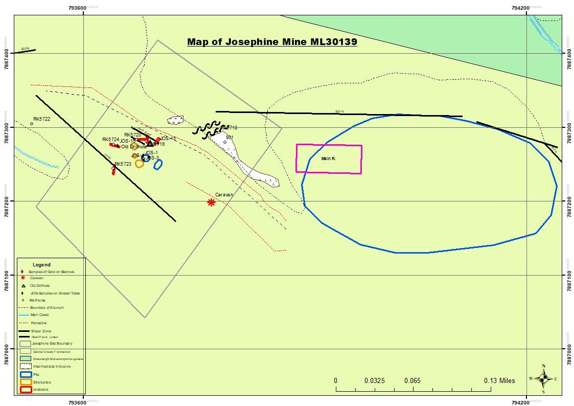
Geological and Minerals Exploration Mapping

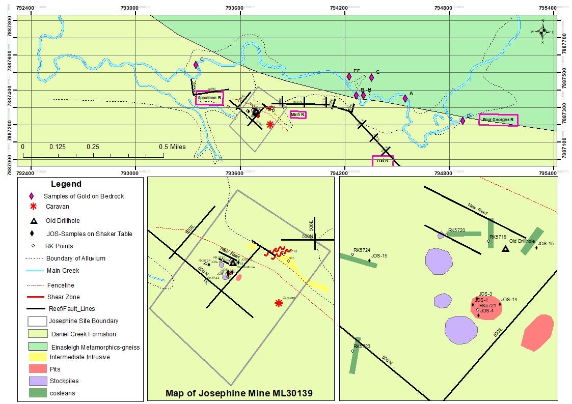
Geological and Mineral Exploration Mapping

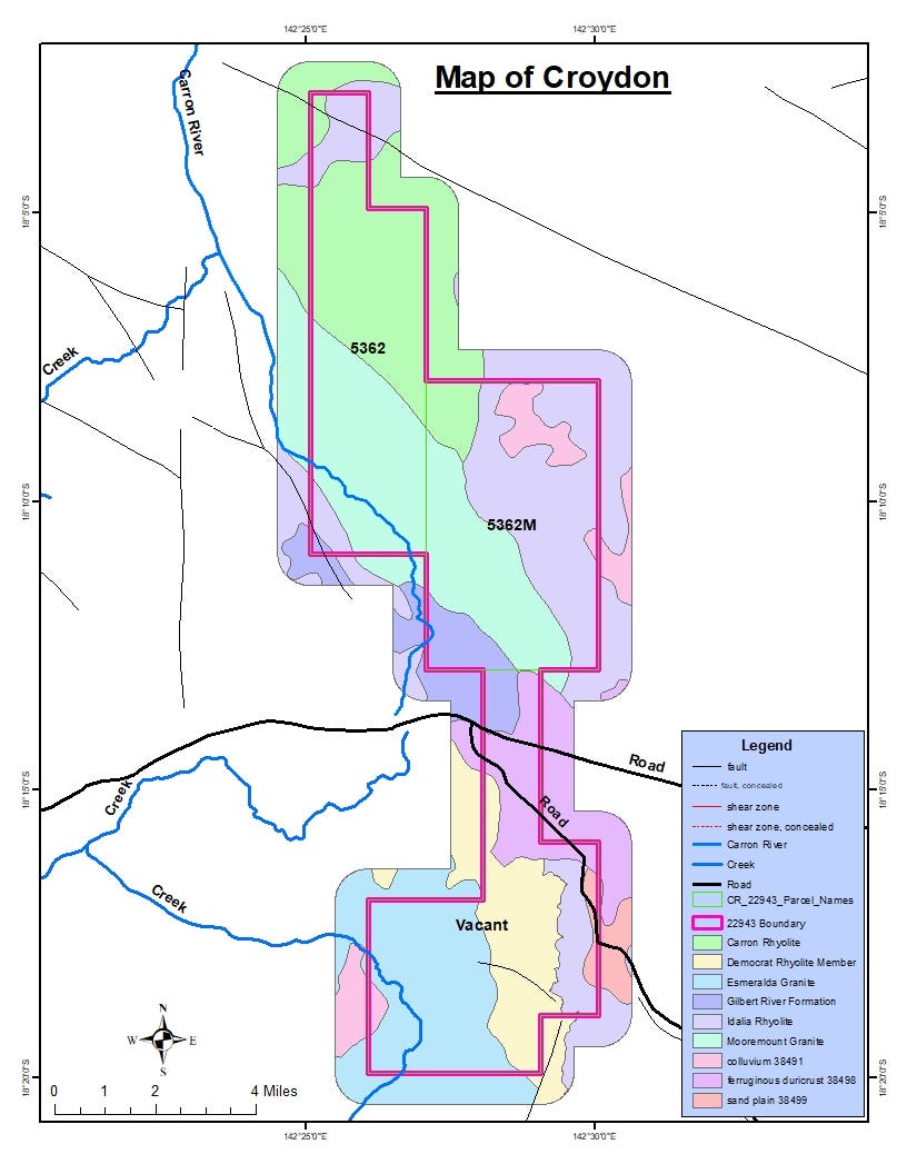
Geological and Mining Map Preparation

Change Detection Analysis & Mapping

Change Detection Analysis & Mapping

Change Detection Analysis & Mapping
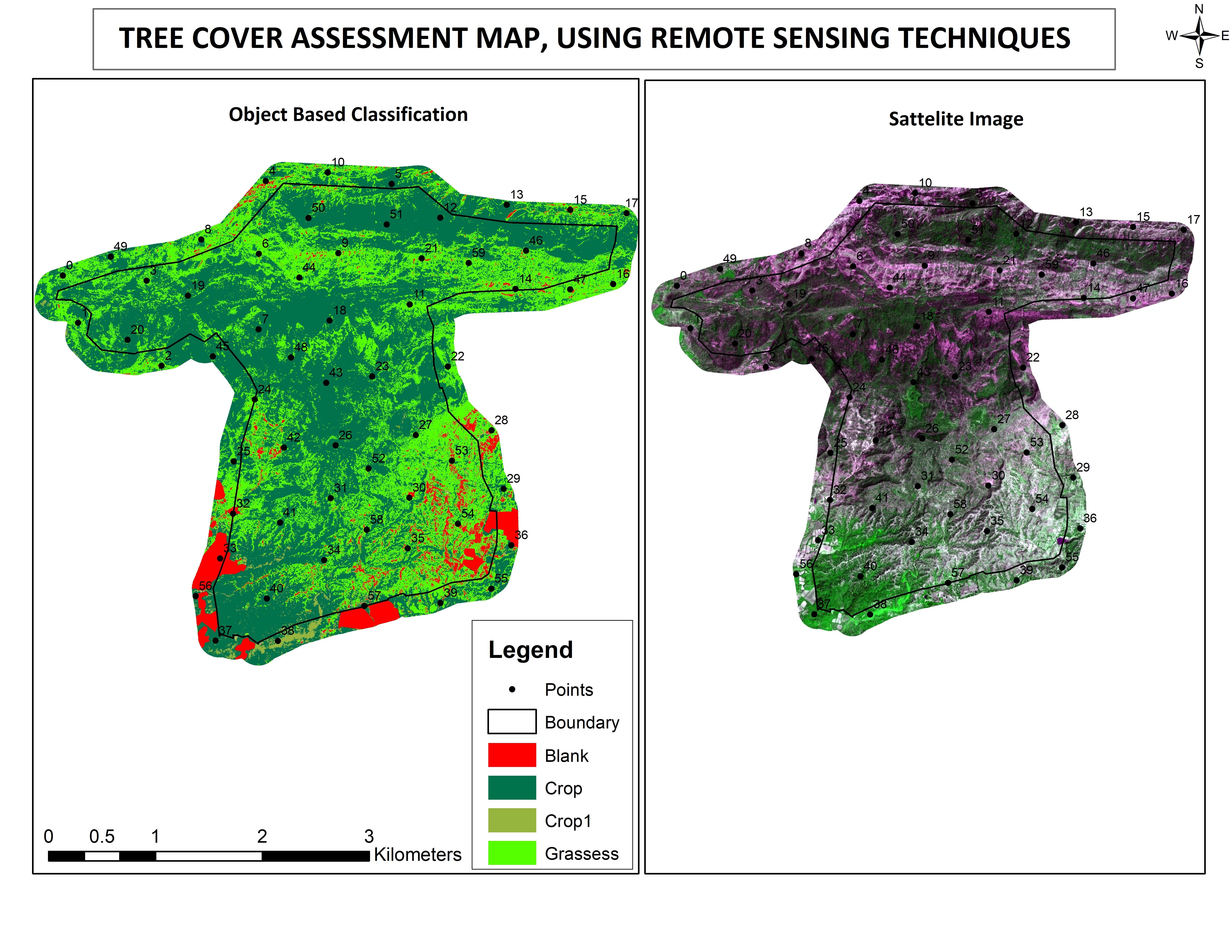

TREE COVER ASSESSMENT MAP, USING REMOTE SENSING TECHNIQUES
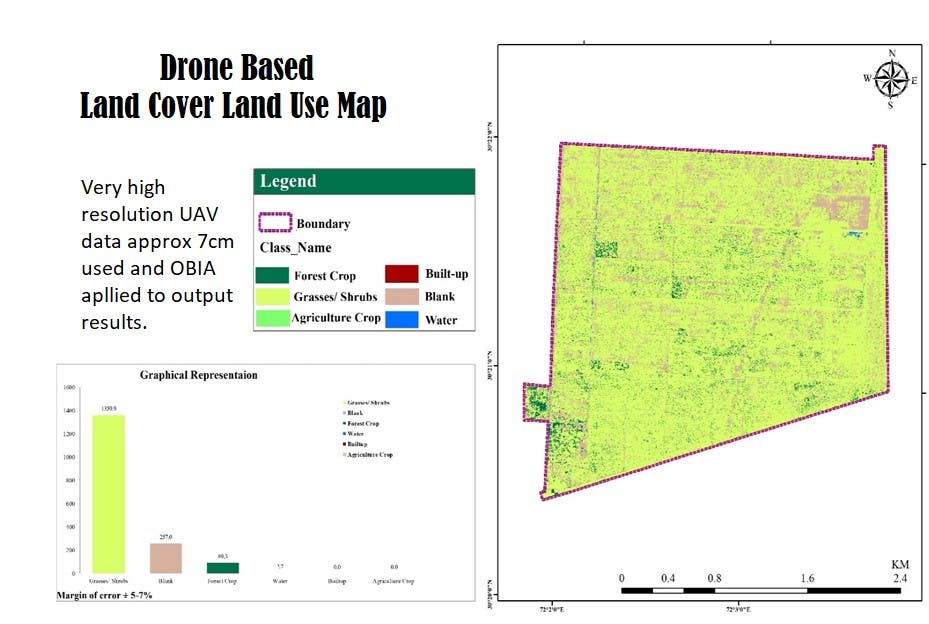

Drone Based Analysis and Mapping
Geological and Minerals Exploration Mapping
Geological and Mineral Exploration Mapping
Geological and Mining Map Preparation
Change Detection Analysis & Mapping
Change Detection Analysis & Mapping
Change Detection Analysis & Mapping
TREE COVER ASSESSMENT MAP, USING REMOTE SENSING TECHNIQUES
Drone Based Analysis and Mapping
评论
变更已保存
这里没有评论!
经验
GIS Analyst
9月 2017 - 2月 2024 (6 年, 5 个月)
GIS data collection, GIS & Remote Sensing Analysis and Mapping, Satellite image processing, Enhancements, Analysis and Interpretation. Object Based Image Analysis, Drone Data processing and Analysis. Very High Resolution Mapping. Land use Land Cover Mapping. Tree Cover Mapping etc.
GIS Professional
5月 2013 - 9月 2017 (4 年, 4 个月)
I have worked on different tasks including GIS data collection, Geocoding, Georefrencing, Digitization, Parcel Mapping, GIS Analysis, Quality Control, GIS Survey, Dashboard data monitoring and updation etc.
教育
M.Phil Geomatics
(2 年)
联系Zia Ul M.询问您的工作详情
登录并通过聊天讨论所有细节。
认证
邀请已发送成功!
谢谢!我们已通过电子邮件向您发送了索取免费积分的链接。
发送电子邮件时出现问题。请再试一次。
加载预览
授予地理位置权限。
您的登录会话已过期而且您已经登出,请再次登录。