

您正在关注
关注用户错误。
该用户不允许他人关注他们。
您已经关注了这个用户。
您的会员计划仅允许0个关注。升级在此。
成功取消关注
取消关注用户错误
您已成功推荐
推荐用户错误。
出问题了,请刷新页面并重新尝试。

联系Mohammad P.询问您的工作详情
登录并通过聊天讨论所有细节。
文件夹
文件夹

GIS for Real estate company
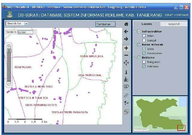

GIS for Monitoring Advertising Billboard Position

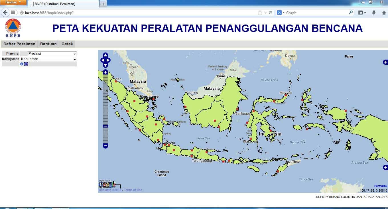
GIS for Supporting National Disaster Management agency

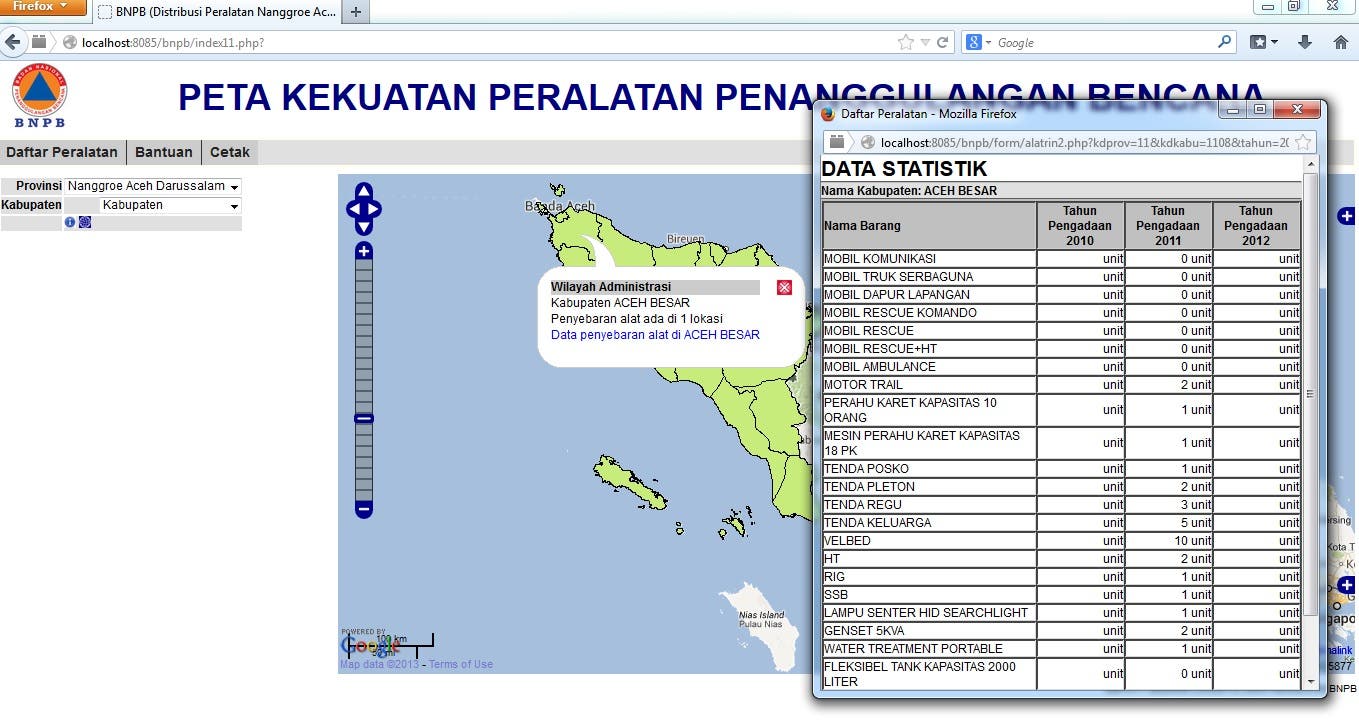
GIS for Inventory of Disastes Equipment Tools

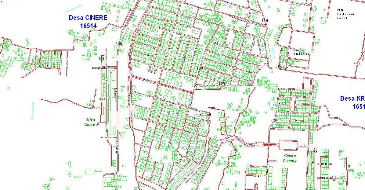
GIS Coastal Databank System
GIS for Tracking System Application
GIS for Real estate company
GIS for Monitoring Advertising Billboard Position
GIS for Supporting National Disaster Management agency
GIS for Inventory of Disastes Equipment Tools
GIS Coastal Databank System
GIS for Tracking System Application
评论
变更已保存
展示1中的1-1条评论
$22.00 USD
PHP
Website Design
Graphic Design
HTML
M

•
经验
GIS Data Migration
11月 2011 - 6月 2012 (7 个月, 1 天)
I am GIS developer for creating tools that related to Data Migration Phase. this project name was "National Spatial Database Infrastructure" (NSDI)
GIS system Manager
1月 2011 - 11月 2011 (10 个月, 1 天)
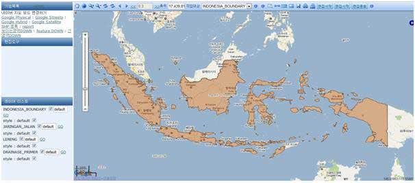
This is project name "Coastal Protection and Management Policies , addressing climate change impact in Indonesia" the application that I am create was name of Indonesia Coastal Databank System (ICDB). this project was owning by Ministry of Planning and Development Republic Of Indonesia and funding by KOICA (Korea International Corporation Agency).
GIS Supervisor
1月 2007 - 8月 2011 (4 年, 7 个月)
as a Supervisor for Color Image Layer Project. I am using PCI Geomatics for create application similar with Google maps. but at that time I am using aerial photograph as a source of data
教育
Bachelor
(6 年)
联系Mohammad P.询问您的工作详情
登录并通过聊天讨论所有细节。
认证
顶级技能
浏览相似作品
邀请已发送成功!
谢谢!我们已通过电子邮件向您发送了索取免费积分的链接。
发送电子邮件时出现问题。请再试一次。
加载预览
授予地理位置权限。
您的登录会话已过期而且您已经登出,请再次登录。